
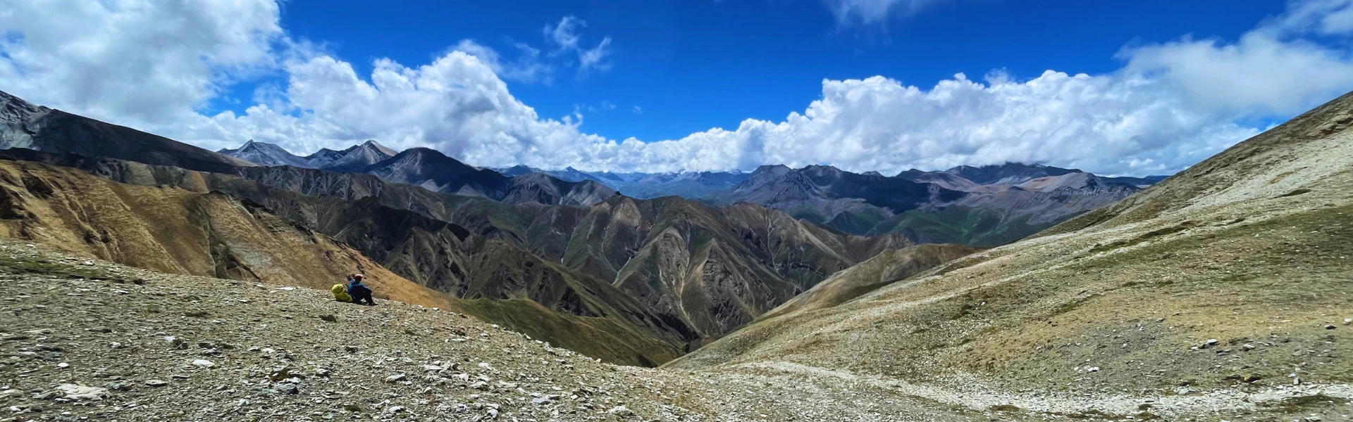
The unreal beauty of the upper Mustang landscape stands as an extraordinary anomaly within the central Himalayas, presenting an ecosystem that subverts the traditional imagery of Nepal’s snow-capped peaks and subtropical valleys. Historically known as the Kingdom of Lo, this restricted northern region of Mustang offers an enchanting blend of high-altitude desert terrain, stark sandstone ramparts, and deep river systems. For centuries, its geographic isolation protected a distinct classical Tibetan culture, preserving an ancient way of life within a dramatic geological fortress. Unlike the lush rhododendron forests of the Annapurna circuit or the dense glacial valleys of the Everest region, Upper Mustang presents an environment characterized by dry, vast wind-sculpted canyons and deeply colored sedimentary rocks that look closer to the American Southwest than the traditional South Asian subcontinent.
The Ultimate Guide to the Upper Mustang Landscape: Geography, Geology, and Trekking Tips
Table of Contents
What Makes the Upper Mustang Unlike Anywhere Else in Nepal?
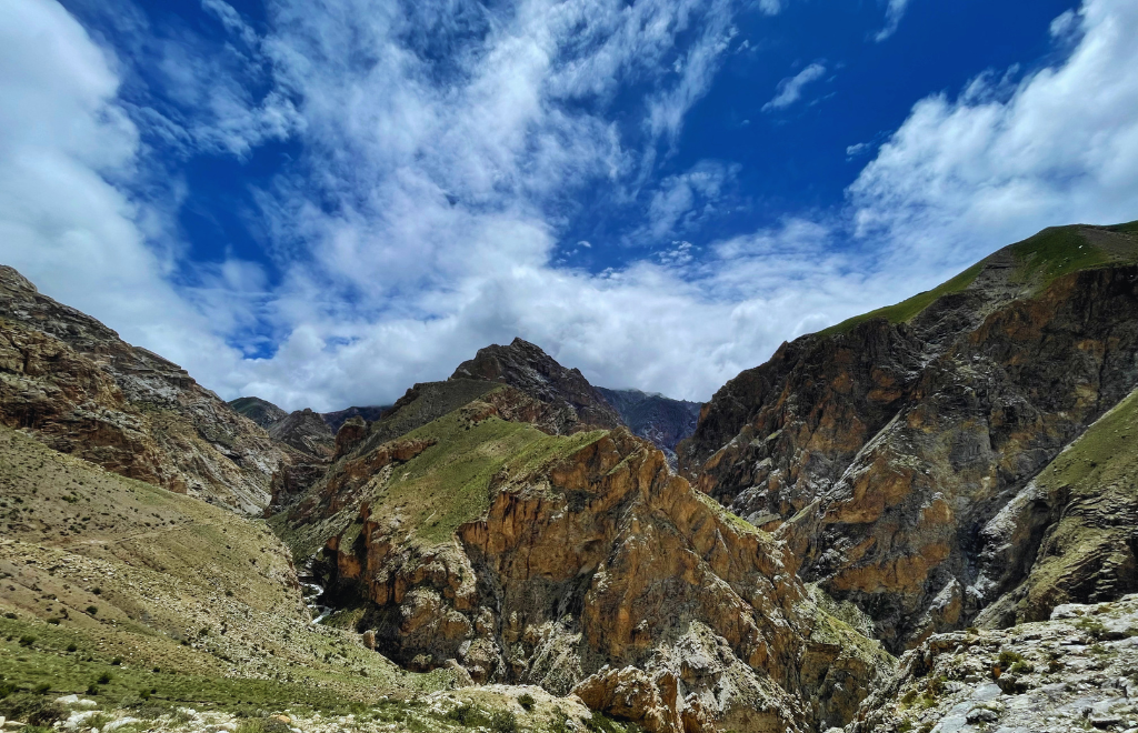
What makes the upper mustang landscape so profoundly unique is its placement behind the massive barrier formed by some of the tallest mountain peaks on Earth. Shielded from the Indian Ocean monsoon by the colossal massifs of Annapurna and Dhaulagiri, the region forms an integral part of the Trans-Himalayan rain shadow zone. This particular positioning results in an average annual precipitation rate that rarely exceeds 200 millimeters, morphing the entire territory into a harsh, cold desert ecosystem. Here, the raw, unmasked architecture of the earth is exposed to open view, displaying millions of years of structural uplifting, continuous tectonic fracturing, and ceaseless wind erosion. For adventure seekers, academic researchers, and landscape photographers, navigating this land means stepping into a vast open-air geological museum where every cliffside tells a story of lost oceans, shifting tectonic plates, and human resilience.
To truly appreciate this ancient realm, one must look closely at its structural geology, its harsh atmospheric climate, and the unique cultural systems that have evolved to survive here. Exploring this region requires more than an ordinary walking itinerary; it demands an understanding of structural features such as the Thakkhola Graben, high-altitude climate profiles, and the historic trade routes that once connected the Indian subcontinent directly to the Tibetan Plateau. As modern infrastructure gradually connects these remote settlements to the wider world, understanding the area's core physical geography becomes ever more critical. Whether you choose to embark on a traditional foot trek or explore the extensive terrain via a rugged overland journey, A1 Excursion Adventure stands ready to guide you through this scientific and cultural wonderland, unraveling the structural mysteries and artistic heritage of Nepal’s legendary Forbidden Kingdom.
Upper Mustang at a Glance: Key Geography Facts
Understanding the fundamental geographical parameters of Upper Mustang helps clarify the dramatic physical environment that trekkers and researchers encounter when visiting the region. The area operates under a high-altitude desert paradigm, presenting unique environmental baselines that shape every aspect of local ecology and travel planning.
| Geographical Metric | Details and Measurements | Traveler Insights & Implications |
| Elevation Range | 2,800 meters (Kagbeni) to over 4,280 meters (Mountain Passes) | Requires careful, staged acclimatization to mitigate Acute Mountain Sickness (AMS). |
| Climate & Rainfall | Trans-Himalayan Rain Shadow; < 200 mm annual precipitation | An ideal trekking destination during the summer monsoon months when the rest of Nepal experiences heavy rain. |
| Major Rivers & Valleys | Kali Gandaki River, Mustang Khola, Tsarang Khola | Serves as the primary navigation corridor, offering a continuous supply of freshwater and exposing deep geological strata. |
| Geological Features | Thakkhola Graben, South Tibetan Detachment System, Sky Caves, Hoodoos | Provides exceptional opportunities for structural geology research and spectacular landscape photography. |
| Best Seasons to Visit | March to November (Including May for the annual Tiji Festival) | Offers clear blue skies, manageable high-altitude pass crossings, and vibrant cultural celebrations. |
Why Does the Upper Mustang Landscape Look Like Tibet?
The visually striking similarities between Upper Mustang and the Western Tibetan Plateau are neither accidental nor superficial; they are the direct consequence of shared structural geology and geographic continuity. Geographically, Upper Mustang extends as a prominent peninsula from the northern edge of Nepal directly into the massive high-altitude Tibetan Plateau. The boundaries that divide Mustang from Tibet are purely political, demarcated along mountain ridgelines that do not interrupt the underlying geological formations. Consequently, the geography of Upper Mustang is an organic continuation of the semi-arid steppe environments of the north, sharing identical high-altitude plateaus, dry alluvial fans, and expansive sky horizons.
This deep physical connection dates back to the early structural uplift of the Greater Himalayas. As the Indian plate continued its relentless northward collision into the Eurasian landmass, the land directly behind the emerging Himalayan crest was elevated uniformly, forming a massive, continuous high-altitude plateau. The ecological systems, vegetation patterns, and geomorphological processes seen in Mustang match those found across the border in Tibet. The low-lying shrubs, sparse alpine grasses, and complete lack of natural arboreal forests are characteristic of this shared cold-desert biome. This historical geographic link allowed for centuries of continuous cultural, religious, and economic exchange, allowing the local Loba people to preserve an authentic Tibetan cultural identity that mirrors the geography of their ancient homeland.
Cliffs, Canyons, and Color: What Mustang's Desert Terrain Actually Looks Like
The physical composition of the Upper Mustang terrain can be visualized as a network of vast, open plateaus carved out by deep, near-vertical river canyons. The color scheme of the landscape shifts constantly throughout the day, depending on the angle of the sun, changing from deep ochres and muted yellows to vivid, burning brick reds and smoky purples. These vibrant, shifting shades are the result of varying mineral compositions within the exposed sedimentary strata, particularly iron oxide formations and ancient clay beds that have been exposed by millions of years of water and wind erosion. The vertical cliffsides are deeply gouged by natural drainage channels, creating thousands of unique vertical columns and fluted sandstone patterns that rise like Gothic cathedrals from the dry valley floor.
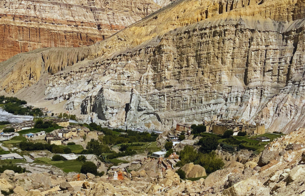
In striking contrast to these barren, scorched clay structures are the vibrant green oases of agricultural fields that mark the locations of human settlements. Wherever a glacial stream flows down from the high mountain peaks, villages like Ghami, Charang, and Lo Manthang have established intricate, gravity-fed irrigation channels. From the high mountain passes, these settlements appear as brilliant emerald jewels dropped onto a vast, dry canvas of desert stone. The neat lines of bright green willow trees, flourishing poplar stands, and neatly terraced fields of pink-blossomed buckwheat and pale green barley form a beautiful, living contrast with the wild, crumbling desert cliffs that surround them. This continuous interplay between extreme aridity and carefully engineered human agriculture shapes the unique spatial visual style of the region.
Why Upper Mustang Receives Almost No Rainfall: The Trans-Himalayan Rain Shadow
The defining environmental characteristic of the Upper Mustang desert landscape is its extreme dryness, a climate condition controlled entirely by the physics of the rain shadow effect. The massive mountain ranges of Annapurna and Dhaulagiri rise to elevations exceeding 8,000 meters, acting as a colossal physical barrier to atmospheric circulation. As the warm, moisture-laden air masses of the summer monsoon move northward from the warm Bay of Bengal across the low plains of India and Nepal, they strike the southern slopes of these massive mountain walls. Forced to rise rapidly to clear these immense high-altitude barriers, the air cools significantly, condensing its moisture and releasing heavy torrents of rain on the southern trekking regions like Pokhara and the lower Annapurna foothills.
By the time these air masses pass over the icy crests of the high Himalayan peaks and descend into the northern territory of Upper Mustang, they have lost almost all their moisture. This descending air warms up rapidly through adiabatic compression, increasing its capacity to hold moisture and preventing the formation of significant rain clouds. This continuous atmospheric process leaves Upper Mustang in a perpetual rain shadow, receiving less than 200mm of total annual precipitation, mostly in the form of light winter snow. This severe lack of moisture prevents the development of deep soils and dense forests, creating a high-altitude desert environment where natural geological erosion proceeds unchecked by vegetation, exposing the raw structural bones of the earth to continuous view.
The Thakkhola Graben: The Rift Valley That Shaped Mustang's Terrain
While the dry climate reveals the underlying rock structure, the architectural shape of the terrain is driven by a tectonic structure known to geologists as the Thakkhola Graben. In the field of structural geology, a graben refers to an elongated block of the Earth’s crust that has dropped downwards between two parallel normal faults, creating a structural rift valley. While the majority of the Himalayan range is characterized by intense horizontal compression and crustal thickening caused by the ongoing collision of the Indian and Eurasian tectonic plates, the Thakkhola Graben represents a fascinating zone of east-west extensional stretching within a broader compressional mountain belt.
This major geological feature extends north-south for over 50 kilometers, creating a deep structural depression that has been systematically filled over millions of years by thick sequences of flowing river and lake deposits, collectively known as the Tetang and Thakkhola Formations. These weakly consolidated layers of ancient gravels, sands, and fine silts are exceptionally vulnerable to the forces of natural erosion. The normal fault systems bounding the graben remain structurally active today, resulting in continuous slow sinking of the basin and regular seismic adjustments that fracture the exposed sedimentary rock faces, creating the iconic sheer cliffs, steep drop-offs, and deep, canyon-like river cuts that define the modern Mustang terrain.
What Is the South Tibetan Detachment System and Why Does Mustang Matter to Geologists?
Adding further complexity to the Upper Mustang geology is the presence of the South Tibetan Detachment System (STDS), a critical structural feature that runs directly through the southern boundary of the region. This is a continuous system of low-angle normal faults that runs along the entire length of the Himalayan arc, marking a profound structural boundary where the high-grade metamorphic rocks of the Higher Himalayan Sequence are separated from the overlying, unmetamorphosed sedimentary rocks of the Tethyan Himalayan Sequence. This unique fault zone allows geologists to study the complex mechanical processes that occur when a mountain range grows so high that its own weight causes the upper sections to pull apart and slide backward toward the north.
For international earth scientists, Upper Mustang serves as an indispensable field laboratory. The deep-cutting action of the Kali Gandaki River cross-cuts these fault zones, providing a clear, continuous view of structural relationships that elsewhere lie buried deep beneath miles of solid rock. By mapping the orientations of the rock strata, tracking fault slip indicators, and analyzing the deformation patterns within the Thakkhola Graben and the STDS, structural geologists can reconstruct the precise timing and movement history of the Himalayan uplift, providing key insights into the geodynamic processes that shape mountain belts worldwide.
Was the Upper Mustang Once an Ocean Floor? The Tethys Sea Story
One of the most mind-bending realizations for trekkers exploring Upper Mustang is that they are walking across the ancient floor of a lost ocean. Long before the Himalayas existed, the continental landmasses of India and Eurasia were separated by a vast body of water known as the Tethys Sea. For tens of millions of years, rivers draining both continents deposited thick layers of marine sediment, mud, and rich organic matter onto this ancient ocean bed. When the two landmasses collided roughly 40 to 50 million years ago, these deep marine sedimentary layers were caught in the massive tectonic squeeze, folded, faulted, and lifted miles into the sky to form the Tethyan Himalayan Sequence that comprises the bedrock of Upper Mustang.
This ancient marine history is made visible to modern travelers through the discovery of unique fossils throughout the valley. The most famous of these are the sacred Shaligram stones—dark, rounded ammonite fossils that date back to the Jurassic period, roughly 140 to 200 million years ago. These coiled marine fossils are found washed clean along the gravel riverbeds of the Kali Gandaki River and its tributaries. To the scientific community, they provide absolute proof of the region's ancient marine origin; to the devout Hindu community, these black fossils are revered as direct manifestations of the god Vishnu, linking the deep geological history of the Earth with local religious traditions.
Geological Insight: How Shaligrams Ended Up at 3,800 Meters > The equation governing the tectonic uplift rate of the Tethyan sediments can be simplified conceptually as:
Natural Forces Shaping the Upper Mustang Landscape
The Kali Gandaki Gorge and the Making of Mustang
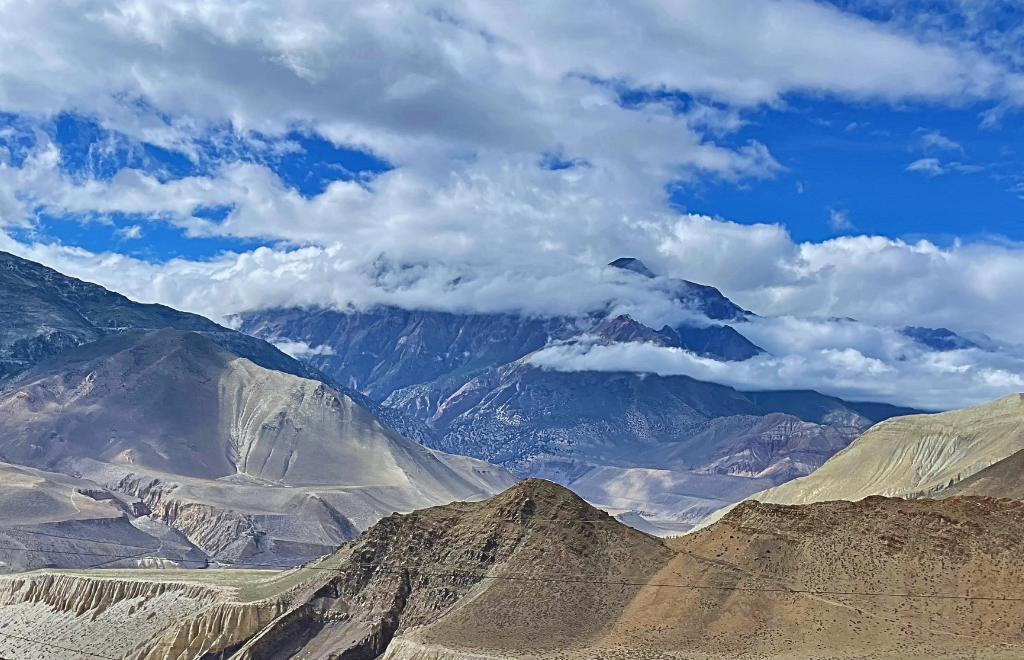
The primary force driving the physical evolution of the Upper Mustang terrain is the relentless flow of the Kali Gandaki Gorge, recognized as the deepest gorge in the world when measured from the towering summits of Annapurna I and Dhaulagiri down to the rushing river bed. The river itself is antecedent, a geographical term meaning that the river system existed long before the mountains surrounding it were pushed upward. As the main Himalayan axis began to slowly rise across its path, the Kali Gandaki maintained its ancient course by cutting downward into the bedrock at an identical rate to the tectonic uplift, creating a deep, narrow canyon through the heart of the world’s highest mountain range.
In the upper reaches of Mustang, this continuous downcutting action has cut directly through the soft, weakly bound sedimentary deposits of the Thakkhola Graben. This deep erosion has created a vast, open valley system characterized by high, vertical cliffsides and wide, braided river channels. The river acts as a natural conveyor belt, carrying millions of tons of eroded desert silt, gravel, and ancient fossils south toward the plains of India. This continuous removal of sediment prevents the valley from filling in, ensuring that the sheer cliffs remain exposed and allowing the forces of wind and weather to continue shaping the rock faces.
How Afternoon Winds Are Still Carving Mustang's Cliffs and Hoodoos
Travelers in Upper Mustang quickly experience the legendary afternoon winds that sweep through the valley. As the powerful morning sun heats the high-altitude Tibetan Plateau to the north, the warm air rises rapidly, creating a strong low-pressure zone. Meanwhile, the cooler, denser air trapped in the deep, narrow southern sections of the Kali Gandaki Gorge is drawn rapidly northward to fill this void, creating a powerful wind that rushes through the valley every afternoon, often reaching speeds of 40 to 60 kilometers per hour.
This consistent, powerful wind carries fine particles of sand and abrasive dust, acting as a natural sandblaster that erodes the soft sandstone cliffsides over thousands of years. This process of wind ablation wears away the softer layers of rock while leaving behind the harder, more consolidated mineral veins, creating spectacular hoodoo rock formations. These natural structures appear as tall, thin spires of rock topped by harder protective stone caps, standing like silent guardians along the trails. The wind also carves deep cavities, natural alcoves, and intricate patterns into the sheer sandstone faces, providing a unique landscape for travel photographers.
Upper Mustang's Weather: Seasonal Extremes and What Climate Change Is Doing to the Trails
The Upper Mustang climate is characterized by extreme seasonal shifts and a harsh daily environment. During the short summer season, daytime temperatures can reach a comfortable 22°C to 26°C, though the intense high-altitude solar radiation makes it feel significantly warmer. However, as soon as the sun drops behind the high mountain passes, temperatures plunge rapidly due to the dry air and complete lack of cloud cover, often dropping close to freezing even in the summer months. Winter brings severe, freezing conditions, with temperatures dropping well below -15°C, accompanied by heavy mountain winds and light snow that freezes the ground solid and closes the high passes, forcing many locals to migrate south to Pokhara or Kathmandu for the season.
In recent years, modern climate change has introduced new environmental challenges to this fragile landscape. Rising global temperatures have led to an accelerating thaw of underground permafrost and high-altitude glaciers, destabilizing the ancient clay and gravel cliffsides. This thawing has caused an increase in sudden rockfalls, unpredictable mudslides, and rapid changes to traditional trekking trails. Furthermore, traditional water sources have become increasingly erratic, as many local springs depend on predictable winter snowfall and glacial meltwater. These changing environmental factors present ongoing challenges for both local farmers and trekking companies, requiring expert navigation and adaptive route planning.
Human Life Within the Upper Mustang Landscape
The Sky Caves of Upper Mustang
Among the most mysterious features of the terrain are the legendary Upper Mustang sky caves, a vast collection of thousands of man-made caves carved directly into the vertical sandstone cliffsides, often positioned hundreds of feet above the valley floor. These remarkable structures are hand-carved into the soft sedimentary rock, organized in vertical stacks that resemble modern apartment buildings. Accessible only via narrow cliff ledges or historical rope ladders, these ancient caves have puzzled international archaeologists and historians for decades, serving as a testament to the incredible engineering skills of the region's early inhabitants.
Comprehensive archaeological studies led by international teams have revealed that these sky caves were constructed in several distinct historical phases, dating back over 2,000 to 3,000 years. The earliest caves were used primarily as complex burial chambers, containing ancient skeletal remains, rich textiles, and valuable funeral goods. During times of tribal conflict and political instability along the ancient salt trading routes, the caves evolved into secure, defensive cliffside settlements where entire villages could retreat for safety. Later, with the spread of Tibetan Buddhism across the region, many caves were converted into isolated meditation chambers, secure libraries for sacred texts, and beautiful rock-cut monasteries adorned with intricate wall paintings. Today, these hollowed-out openings stand as a fascinating feature of the landscape, prompting travelers to wonder how ancient builders managed to carve out such complex structures at such dangerous heights.
Glacial Irrigation and Desert Agriculture in Mustang Region
Survival within this high-altitude desert environment of the mustang requires highly sophisticated water management systems. Because direct rainfall is so sparse, local agriculture depends entirely on the systematic diversion of glacial meltwater streams flowing down from the high mountain massifs. Over generations, the Loba people have constructed intricate networks of gravity-fed irrigation channels that catch water from high mountain streams and carry it across miles of dry alluvial fans directly to the terraced fields of the settlements.
This precious water supply is shared according to historic customary laws, ensuring that every family within the village receives a fair share of water based on the seasonal farming calendar. The primary crops grown in these high-altitude fields are traditional staples like barley and buckwheat, which are uniquely adapted to short growing seasons, poor soil quality, and low moisture conditions. In lower elevations, villages have successfully established thriving apple orchards, producing crisp, high-quality mountain apples that have become an important source of income. This sustainable farming system showcases the incredible resourcefulness of the local population, turning a barren desert landscape into a productive agricultural environment.
How the Upper Mustang Landscape Shaped Loba Culture
The layout and design of human settlements in Upper Mustang are a direct reflection of the surrounding geography and climate. Villages are carefully positioned in sheltered river bends or beneath protective cliff faces to shield them from the powerful afternoon winds. The traditional architecture uses locally sourced materials, featuring flat-roofed houses built from sun-dried mud bricks and finished with a smooth layer of protective white clay. The flat roofs serve a practical purpose, providing a sunny workspace for drying crops, storing scarce firewood, and gathering for family activities, while also helping to retain heat during the freezing winter nights.
This close relationship between geography and culture extends deep into the spiritual life of the Loba people, where the natural terrain is seen as a sacred landscape inhabited by powerful spiritual forces. Massive stone chortens and extensive mani walls (built from hand-carved prayer stones) are strategically placed at important geographical points, such as high mountain passes, river crossings, and village entrances. These sacred structures are built to balance the natural elements, protect travelers from malevolent spirits, and bring spiritual harmony to the land. By weaving their spiritual beliefs into the physical landscape, the Loba people have created a rich cultural heritage that is deeply intertwined with the geography of their ancient homeland.
What to Expect on the Upper Mustang Trek: Landscapes, Culture, and Key Highlights
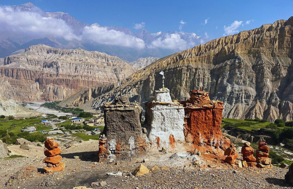
The Upper Mustang Trek is much more than a mountain adventure. It is a journey through Nepal’s largest high-altitude desert, the ancient Kingdom of Lo, and one of the most culturally preserved regions in the Himalayas. As you leave the green valleys behind, the landscape transforms into a dramatic world of wind-carved canyons, colorful cliffs, barren plateaus, ancient cave systems, and traditional Tibetan-style villages.
Along the trail, you will cross high mountain passes such as Yamda La and Nyi La, visit centuries-old monasteries, and experience the unique traditions of the Loba people. The trek combines breathtaking scenery with rich cultural and spiritual heritage.
- Lo Manthang – The Walled Kingdom: The highlight of Upper Mustang, Lo Manthang, is a medieval walled city founded by King Ame Pal in 1380. Ancient monasteries, royal palaces, and traditional homes offer a glimpse into Mustang’s royal past.
- Chhoser and the Jhong Cave Complex: Near the Tibetan border, these remarkable multi-story caves carved into towering cliffs showcase the ingenuity of Mustang’s early inhabitants and provide fascinating insight into the region’s history.
- Dhakmar and Ghami: Dhakmar is famous for its striking red cliffs, while nearby Ghami is home to the longest Mani wall in Upper Mustang, reflecting the region’s deep Buddhist traditions.
- Charang or Tsarang and Ghar Gompa: Charang was once an important political and religious center, while Ghar Gompa, associated with Guru Padmasambhava, is one of Mustang’s most revered monasteries.
- Luri Gompa: Hidden within a cliffside cave, Luri Gompa is renowned for its ancient murals, sacred chortens, and unique Buddhist artwork.
- Kagbeni – The Gateway to Mustang: This ancient village marks the entrance to Upper Mustang, featuring narrow alleys, traditional mud-brick houses, and centuries-old monasteries.
- Damodar Kunda: Located in the remote northeastern region of Mustang, this sacred high-altitude lake is an important pilgrimage site for both Hindus and Buddhists.
- Saribung Pass and Saribung Peak: Adventure seekers can extend their journey to Saribung Pass (6,042 m) and Saribung Peak (6,328 m), experiencing remote glaciers, rugged mountain terrain, and spectacular Himalayan views.
- The Kali Gandaki Gorge and High-Altitude Desert: Throughout the trek, you'll walk through one of the world's deepest river gorges, surrounded by vast desert landscapes, colorful rock formations, dramatic canyons, and panoramic Himalayan scenery that make Upper Mustang unlike anywhere else in Nepal.
- Authentic Loba Culture and Tibetan Buddhist Heritage: Beyond the landscapes, the trek offers an opportunity to experience the traditional lifestyle of the Loba people. You will encounter centuries-old monasteries, colorful chortens, prayer flags fluttering across mountain ridges, and warm local hospitality that reflects Mustang’s strong Tibetan cultural roots.
From ancient cave cities and sacred monasteries to dramatic red cliffs and medieval walled towns, the Upper Mustang Trek delivers a rare combination of adventure, culture, history, and breathtaking Himalayan scenery that cannot be found on any other trekking route in Nepal.
Want to know more about this topic? Read our full blog below for a complete guide.
Best Photography Locations in Upper Mustang
To capture the ultimate visual essence of the Upper Mustang photography experience, precise timing and positioning relative to the high-altitude sun are crucial. The following locations offer exceptional composition opportunities:
- Sunrise at Lo Manthang: Position yourself on the high eastern ridges overlooking the walled city at dawn. The first rays of the morning sun strike the high snow peaks of the Himalayas in the distance before illuminating the ancient mud-brick walls and watchtowers of the city, creating a striking contrast against the dark valley floor.
- The Red Cliffs of Dhakmar at Golden Hour: Plan your visit to Dhakmar for the late afternoon, between 3:30 PM and 5:30 PM. As the sun sinks lower in the sky, its warm light hits the iron-rich sandstone cliffs directly, making them glow with a brilliant fire-red intensity that contrasts beautifully with the blue sky.
- The Sky Caves of Chhoser: Use a wide-angle lens from inside the high window openings of Jhong Cave. Frame the dark, hand-carved mud window openings in the foreground against the bright, sunlit checkerboard fields and winding river channels of the valley floor below.
- The Long Mani Wall at Ghami: Shoot from a low angle along the side of the 240-meter-long stone wall during the middle of the afternoon. Use the long, colorful prayer-carved stones as a natural leading line pointing toward the dramatic, multi-colored mountain passes in the background.
- Ancient Monasteries and Prayer Flags: Capture the contrast between the dark, weathered wood and red clay walls of Chodey Gompa against the bright, moving colors of newly hung prayer flags blowing in the strong afternoon wind.
Upper Mustang Jeep Tour vs Trek: Which Is Right for You?
Trekking Routes Through the Upper Mustang Landscape
Navigating the terrain can be done through different routes, depending on your preferred travel style, physical fitness level, and available time. Consulting a comprehensive Upper Mustang travel guide helps clarify these options, ensuring you select the route that best fits your expectations.
The Classic Upper Mustang Trek Route remains the top choice for traditional hikers. This route takes 14 to 18 days, beginning in Jomsom and following the ancient walking paths along the Kali Gandaki River floor before climbing up through villages like Samar, Ghami, and Charang to reach Lo Manthang. The return journey loops through the remote eastern villages of Yara and Tangbe, providing a varied experience that avoids walking the same path twice.
For travelers with less time, the Short Upper Mustang Trek Route takes 10 to 14 days by utilizing the newly constructed mountain dirt roads to drive past lower sections and focus your walking days exclusively around Lo Manthang and the surrounding sky caves.
Discover more details and helpful insights in the full blog below.
Essential Trekking Gear for Upper Mustang
Packing the correct Upper Mustang trekking gear requires preparing for a unique combination of high-altitude cold, intense desert sun, and powerful afternoon winds. The gear list differs from standard trekking routes due to the region's dry, desert conditions.
- Windproof Outer Layers: A high-quality, breathable windcheater jacket and windproof trekking pants are absolutely essential to protect against the strong afternoon winds that blow through the valley daily.
- UV Sun Protection: Due to the thin atmosphere and high-altitude solar reflection, bring UV-blocking sunglasses, high-SPF sunblock, and a wide-brimmed sun hat to prevent sunburn and eye strain.
- Hydration Systems: Pack two wide-mouth insulated water bottles or a heavy-duty hydration bladder with a total capacity of at least 3 liters, along with water purification tablets or an electronic UV purifier to stay hydrated in the dry air.
- Dust-Proof Gear Protection: Bring durable, sealable dry bags and camera wraps to protect your electronic equipment, lenses, and extra clothing from the fine silt and abrasive dust carried by the afternoon winds.
- Sturdy Footwear & Gaiters: Wear broken-in, high-top trekking boots with good ankle support to navigate loose gravel slopes, and light trail gaiters to keep fine sand and stones out of your shoes.
Want to go deeper? Read the full blog below for everything you need to know before you go.
Upper Mustang Overland Jeep Tour Guide
For travelers who prefer not to complete a long foot trek, an Upper Mustang overland tour offers an excellent alternative. The construction of the northern road corridor has made it possible to explore the entire region from Jomsom to the Tibetan border using a rugged 4x4 mountain vehicle. An Upper Mustang jeep tour significantly reduces travel times, allowing you to reach the walled capital of Lo Manthang in just 3 to 4 days of driving from Pokhara, making the region accessible to family groups, older travelers, and those with physical limitations.
When comparing a jeep tour to a traditional foot trek, each style offers distinct advantages. A jeep tour provides greater physical comfort, protects you from the powerful afternoon winds, and allows you to cover large distances quickly. However, driving over the rough, unpaved dirt tracks can be bumpy and physically tiring.
A traditional foot trek allows you to experience the landscape at a slower pace, explore remote cliffside paths that vehicles cannot reach, and enjoy a more gradual acclimatization process. Many modern travelers choose a hybrid itinerary, enjoying a classic foot trek on the way up and booking a comfortable jeep ride for the return journey south.
Upper Mustang Altitude and Acclimatization Guide
Managing your ascent profile is critical when traveling through Upper Mustang, as the route requires crossing several high mountain passes over 3,800 meters. Proper acclimatization is key to preventing altitude sickness and ensuring a safe, enjoyable journey.
| Trek Day / Location | Altitude (Meters) | Acclimatization Strategy & Safety Actions |
| Jomsom (Start Point) | 2,720 m | Begin tracking hydration levels; maintain a steady, unhurried walking pace. |
| Chele Village | 3,050 m | First significant altitude increase; avoid alcohol and rest early. |
| Syangbochen | 3,800 m | Cross Yamda La Pass (3,860m); climb high and sleep low where possible |
| Lo Manthang (Capital) | 3,840 m | Spend 2 full nights here; complete light daytime side trips to Chhoser without overexertion. |
| High Mountain Passes | 4,010 m (Nyi La) | Cross steadily without extended stops at the highest point; descend immediately if showing symptoms of AMS. |
Read the full blog below. The details in there could save you time, money, and a few headaches on the road to Upper Mustang.
Upper Mustang Trek Responsibility while Traveling
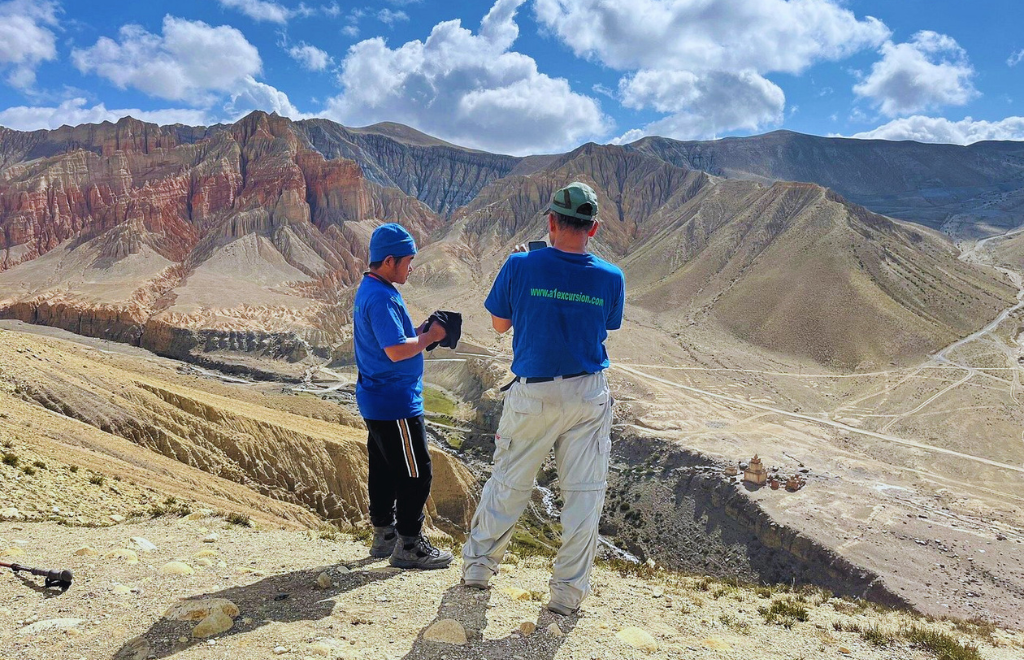
Protecting the Fragile Upper Mustang Landscape
The dry climate and high altitude make Upper Mustang an exceptionally fragile ecosystem. Because waste decomposes very slowly in cold, desert conditions, managing non-biodegradable trash is a major challenge. To protect the environment, travelers should minimize plastic use by carrying reusable water bottles and water purification systems and ensure they pack out all personal trash. Staying on established trails is also important to prevent accelerated erosion on the loose sandstone slopes.
Practicing responsible tourism also means respecting the local culture and supporting the community economy. Always ask for permission before taking photos of residents, monastic interiors, or private homes, and walk clockwise around chortens, mani walls, and sacred shrines. You can support the local economy directly by staying in locally owned teahouses, hiring licensed local guides and porters, and purchasing authentic handicrafts. By making sustainable choices, we help preserve the unique environment and vibrant heritage of the Loba people for years to come.
Explore Upper Mustang with A1 Excursion Adventure
A1 Excursion Adventure provides a variety of carefully planned itineraries tailored to different travel styles, fitness levels, and scheduling requirements. Our experienced team handles all logistical details, including booking reliable transportation, arranging comfortable teahouse accommodations, and securing the mandatory restricted area permits, ensuring a seamless, stress-free journey through the Forbidden Kingdom.
- Classic Upper Mustang Trek
- Short Upper Mustang Trek
- Upper Mustang Overland Jeep Tour
- Upper Mustang Tiji Festival Trek
Final Thoughts
The magnificent upper mustang landscape stands as a brilliant example of the incredible beauty that results when deep tectonic forces, an arid rain shadow climate, and a resilient, ancient culture come together in perfect harmony. From the structural rifting of the Thakkhola Graben and the ancient marine legacy of the Tethys Sea fossils to the legendary hand-carved sky caves and the vibrant green farming oases, Upper Mustang offers an adventure experience that is unique within the global mountain landscape. It is a destination that challenges our understanding of the Himalayas, inviting us to explore a vast, quiet world of multi-colored sandstone cliffs, wind-sculpted hoodoos, and deep, ancient canyons.
Traveling through this restricted northern kingdom is more than an ordinary holiday; it is a profound journey through geological time and living cultural history. As modern infrastructure continues to connect this remote valley with the wider world, the opportunity to experience its raw, authentic character remains an extraordinary privilege. Whether you choose to hike along the ancient stone paths or explore the vast horizons via a rugged overland tour, the desert terrain of the Forbidden Kingdom promises to leave a lasting impression on your spirit of adventure.
Contact A1 Excursion Adventure today to begin planning your personalized journey to the legendary Upper Mustang,and let our expert team guide you through the wonders of this unforgettable Trans-Himalayan realm.
Frequently Asked Questions
Why is Upper Mustang called a cold desert?
Upper Mustang is classified as a cold desert because its position in the Trans-Himalayan rain shadow blocks the Indian Ocean monsoon, keeping annual rainfall below 200mm. Its high elevation (above 2,800m) results in freezing winter temperatures and cold nights year-round, despite hot daytime sun.
How was the upper-mustang-landscape formed?
The upper-mustang-landscape was formed by the collision of the Indian and Eurasian tectonic plates, which lifted the ancient Tethys Sea floor. This uplift created the Thakkhola Graben rift valley, which was filled with thick sedimentary layers that have been systematically shaped over millions of years by the downcutting of the Kali Gandaki River and intense wind erosion.
Why does Upper Mustang look like Tibet?
Upper Mustang looks like Tibet because it is a direct geographical extension of the Tibetan Plateau. It shares the same high-altitude steppe terrain, arid climate, and sparse vegetation, which also allowed the local Loba people to maintain a closely linked classical Tibetan culture.
What is the Thakkhola Graben?
The Thakkhola Graben is a major north-south-trending structural rift valley formed by extensional faulting within the compressional Himalayan range. This tectonic depression accumulated deep layers of loose sand and gravel, which have eroded into the sheer cliffs and deep canyons seen today.
What are the Sky Caves of Upper Mustang?
The Sky Caves are thousands of ancient, man-made chambers carved directly into vertical sandstone cliff faces. Dating back over 2,000 years, they were used in phases as burial chambers, defensive settlements during conflicts, and later as Buddhist meditation chambers and monasteries.
What fossils are found in Upper Mustang?
The region is famous for Jurassic-period ammonite fossils known as Shaligrams, which date back 140 to 200 million years. Found along the gravel beds of the Kali Gandaki River, these black fossils provide clear scientific proof that the region once sat at the bottom of the ancient Tethys Sea.
What is the Kali Gandaki Gorge?
The Kali Gandaki Gorge is the world's deepest gorge, carved by an ancient river that existed before the mountains rose. As the Himalayas lifted, the river cut through the bedrock at an identical rate, creating a deep canyon that separates the Annapurna and Dhaulagiri massifs.
What is the best time to visit Upper Mustang?
The best time to visit is from March to November. Because it sits in a rain shadow, Upper Mustang is an ideal trekking destination during the summer monsoon months (June to August) when other parts of Nepal experience heavy rain. May is also popular for the Tiji Festival.
Can Upper Mustang be explored by a Jeep?
Yes, the construction of the unpaved road corridor allows travelers to complete an overland tour via a 4x4 jeep. This option significantly reduces travel times and physical demands, making the spectacular desert scenery and cultural sites accessible to a wider audience.
What trekking gear is required for Upper Mustang?
Essential gear includes high-quality windproof outer layers to protect against strong afternoon winds, heavy-duty UV sun protection (sunglasses, high-SPF sunblock), dust-proof dry bags for electronics, robust hydration bottles, and broken-in trekking boots with trail gaiters.
How difficult is the Upper Mustang Trek?
The trek is considered moderately challenging. While it does not reach extreme altitudes like Everest Base Camp, hikers must walk 5 to 7 hours daily over loose gravel terrain, cross several passes around 4,000 meters, and manage strong afternoon winds and dry air.
Which places should not be missed in Upper Mustang?
Essential destinations include the historic walled capital of Lo Manthang, the multi-story Chhoser sky caves, the vibrant red cliffs of Dhakmar, the long Mani wall at Ghami, the cliffside Charang Palace, and Ghar Gompa—one of the world's oldest operating Tibetan Buddhist monasteries.

.webp)